Geographic location
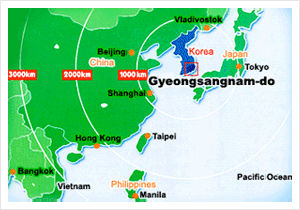
Gyeongsangnam-do is located in the southeast region of the Korean peninsula and meets Busan and Ulsan Metropolitan City on its eastern border, and Namhae on its southern border.
The northern border of Gyeongsangnam-do faces Dalseong of Daegu Metropolitan City and Cheongdo, Goryeong, Seongju and Gimcheon of Gyeongsangbuk-do. Gyeongsangnam-do borders Muju, Jangsu and Namwon of Jeonbuk State and Gurye and Gwangyang of Jeollanam-do th the west.
The geographic coordinates of Gyeongsangnam-do is of between 34° 29’ and 35° 54’ north latitude and between 127° 34’ and 129° 13’ east longitude. The longitudinal coordinates are similar to that of Kyoto and Nagoya in Japan, Kypros in the Mediterranean coast and Oklahoma in the U.S.
| Longitudinal and latitudinal limits | Extension | ||
|---|---|---|---|
| Direction | Location | Limit | |
| East end | San 66, Yongdang-ri, Ungsang-eup, Yangsan-si |
129° 13’ east longitude, 35° 24’ north latitude | 150km from east to west 158km from south to north |
| West end | San 372, Beomwang-ri, Hwagae-myeon, Hadong-gun |
127° 34’ east longitude, 35° 18’ north latitude | |
| South end | San 442, Sangju-ri, Sangju-myeon, Namhae-gun |
128° 05’ east longitude, 34° 29’ north latitude | |
| North end | San 17, Bonggye-ri, Goje-myeon, Geochang-gun |
127° 53’ east longitude, 35° 54’ north latitude | |
Area
The current area of Gyeongsangnam-do is 10,532.7㎢ and accounts for about 10.5% of the total area of South Korea. It is the fourth largest municipality following Gyeongbuk, Gangwon and Jeonnam. Gyeongsangnam-do has around 400 islands, which include Geoje and Namhae, which account for about 8.5% of the total area of Gyeongsangnam-do.
Climate
Located in the far southeast corner of the Korean peninsula, Gyeongsangnam-do borders the sea to the south. This coastal area influences the province considerably because it is confined by high mountains to the north, which shuts out the cool winter wind from the northwest. This creates the most moderate climates in Korea with 12 to 13℃ annual average temperature, 1,400 to 1,800℃ annual precipitation level and -0.5 and 25.1℃ of mean temperature in January and August respectively. The annual average temperature, the precipitation level and the average temperature of January and August is 14 to 15℃, 1,400 to 1,800℃ and 2.3 and 25.9℃ respectively, along its coastal area.
Topography
The tails of Taebaeksan Mountain range reaches the east of Gyeongsangnam-do, while Nakdonggang River flows in the midst of the mountain range. Gyeongsangnam-do borders a rather rugged Sobaeksan Mountain range to the west, which separates it from Honam province. The area below the altitude of 100, between the altitude of 100 to 500, between altitude of 500 to 1,000 and over the altitude of 1,000m occupies 37%, 49%, 12% and 2% respectively, of the province. Cheonhwangsan Mountain- (1,189m) and Shinbulsan Mountain- (1,209m) protrude to the tail of Taebaeksan Mountain range in the eastern mountain area. Central lowland stretches out along the Nakdonggang Basin, in which the Nakdonggang River collects the tributaries of Gyeongsangnam-do and flows out to Namhae developing Gimhae delta plain around its lower reach. Jirisan Mountain- (1,915m), Deogyusan Mountain- (1,614m) and Baegunsan Mountain- (1,279m) stand in a line in the west, and there is rugged area of the province.
Coast and sea
The Namhae coast where the Sobaek mountain range submerges, is composed of the deep sea and embayment area. With its bulging and sinking topography, the Namhae Coast made Dadohae, a collection of countlessly scattered islands. Hallyeosudo, its nearby coastal area and the battlefield of Chungmugong, is a national coastal park with Tongyeong.